Dose anyone know if you can import a “google map” into some other site that has profiling? Failing that I’m just gonna have to punch the route into bike map myself, huff. Cheers boys n girls
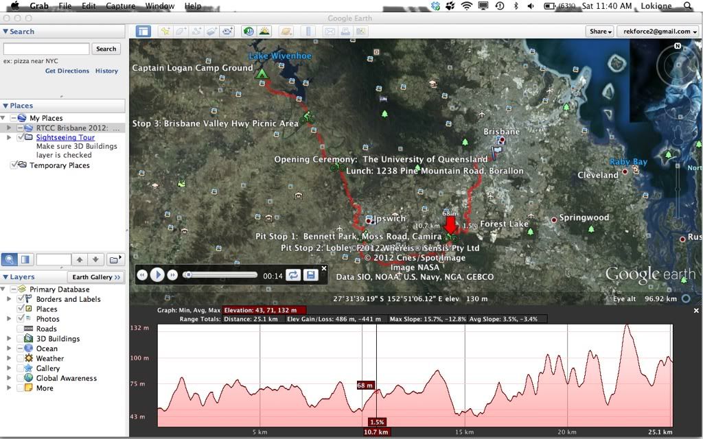
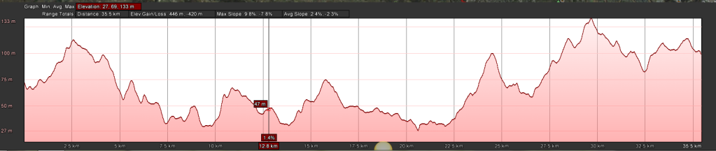
Explore the elevations of a particular path through the Elevation Profile. To start, either draw a path or open an existing one. Once you’ve chosen a path from the Places panel, there are two ways to see its Elevation profile. Either go to Edit > Show Elevation Profile, or right-click on your path from the Places panel and select Show Elevation Profile. An Elevation Profile will appear in the the lower half of the 3D Viewer as shown below:
The Y-axis of the chart displays the elevation, and the X-axis of the chart displays the distance. When you move the cursor through the various parts of the Elevation Profile, the arrow moves along your path and displays the elevation (left side of arrow) and cumulative distance (above the arrow). The % number displayed represents the % grade or slope.
If you’d like to select a specific portion of the path, hold the left-click button on your mouse while you move the cursor over the desired area, then release the button. This metrics above the line chart will then be displayed for this specific part of the path, and the graph will automatically highlight this section.
To change the metrics’ scale between feet and meters, select Tools > Options and select your preference under the category Show Elevation.
Cheers man, but no luck. I cant seem to save the route and export it or import it to the google earth app! Tried doing it through the “my places” bit with no luck either.
No wait, I did it. Using the edit menu blah blah blah > no godd but if you just right click on the route you can select elevation profile there. Hooray