Gravel/touring road questions and link ups

So to keep all of my dribble in the one thread, and maybe even to find some nice new roads to ride. Post it all in here.

I’ll start.

I’m heading out the yarra trails, up through eltham/kangaroo ground, along henley to Skyline road. Then ‘insert road here’ and onto healesville. I’d like to avoid the main road as much as possible, the rest isn’t set into stone but I’d like to keep it as much gravel/singletrack/off main road as I can.

Depends how direct you want to make it :slight_smile:

If I wanted to get there fast I’d drop down main road to Yarra Glen and then take Old Healesville Road. Paved, less traffic than Healesville-Yarra Glen Road.

A way with more climbing and more fun would be to go to the end of Skyline, down Tuans Track (singletrack), Valley Road to Steels Creek Road. Then Pinnacle Lane, Beachs Lane, Old Toolangi-Dixons Creek Road (all three are dirt) up to Toolangi and then down Myers Creek Road to Healesville. Those are the roads we took from Skyline to Toolangi on the recent MGG ride (Scooter’s Century).

Nice idea for a thread :slight_smile:

Thanks. I think time (aka my slow weak legs) say old healsville road.

thought this was relevant for here.

http://www.fixed.org.au/forums/f9/best-way-get-summit-mt-saint-leonard-30788/

Did a great ride this morning. Train to Lillydale -> Yarra Glen -> Healesville (via Old Healesville Rd) -> Donna Buang (via Don Rd / Donna Buang Rd) -> Warburton -> Lilydale (via rail trail). About 110km, close to half of it unsealed.

Never been up the other side of Donna Buang before. Pretty great. Once you turn into the Donna Buang Rd from Don Rd it’s unsealed up the hill for maybe 12-14km, but not too steep and not rough. Was totally fine on my roadie with 28mm tyres. Pops you out pretty close to the summit of Donna. Would be a great unsealed link up to then continue along Acheron Rd rather than heading back down to Warburton.

my first TWBD was going that way up donna buang. in the middle of winter, with the road closed and 2mm of snow on the top of climb. it wasnt so smooth due to fallen branches and other debris. there was slush from where you rejoin the main road to the summit. was really good (when i wasnt bribing myself to keep going to the next road sign with sesame snaps). the descent down was brutally cold on the hands, i can remember not being sure if i was braking or not at one point. however the fruit scroll i had at the summit that i stuffed my last banana in was surpassed only by the views up there.

we started from fed sq and went via mount evelyn and launching place along the marroondah i think. this was back when angry only rode fixed and he did the whole thing with ~68".

Fixed on a gear that large is nuts.

Had a similar experience coming down with frozen hands. We had 5cms land at the top. Was my first time in snow, my first time seeing lyrebirds, and just an amazing ride all round.

Thought I might as well put it here:

Colac -> Lake Elizabeth (~65kms not sure how much climbing maybe 600m or so).
Lake Elizabeth -> Marshall via Lorne (120kms, 2000m climb).

So, Colac to Gellibrand is a nice and easy 25km roll on a rail trail, ok coffee and food in Gellibrand.

Rail Trail.

Then Gellibrand East road that turns into Lardners track is a nice ride up the river, past Dandos Camp, onto Sayers Vista, across the river onto Bridge track which is steep in places and had me walking due to my unsuitable gearing (34t ring to a 11-27 cassette -what was in the shed), then right onto Ridge road and onto Roadknight creek road which takes you down to Forrest.

Bridge rd.

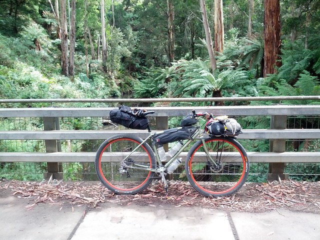
Its almost all gravel and really nice riding.

Couple of beers at the Forrest brewery, then it started pouring, proper thunderstorm, so I stayed for a pobbelbonk.

Milled around and had some dinner, then up the hill to Lake Elizabeth got a little wet with another short burst of rain, good campsite, toilets, water tank which is from the roof of the toilets so probably ok to drink, fire boxes. Was a bit damp but nice.

Then up the hill and just follow road ‘22’ (Mount Sabine/Benwerrin rd) or just follow the signs to Lorne.
Was cool up in the mist, saw a dozen wallabys and no cars. Wish I bought my toe covers for the downhills.

Down Erskine Falls road to Lorne, was strange turning up in 3 layers and gloves and my hands frozen and everyone else in shorts and t’s.

Back up Lorne-Deans Marsh road, easy 3-5% climb sealed and narrow but drivers were nice, turned right onto Seaview road, right onto Bambra-Boonah rd (was gonna go left down to Deans Marsh but wind was coming strong from the west. Then down some unnamed ‘private’ forrestry roads to Paddy’s swamp road which takes you out to Winchelsea.

Found this on those unnamed logging tracks.

Got to the turn off to Winchelsea, and it was either 4kms into the wind and a 4hr wait at the station or 35kms with a cranking tail wind to Marshall and much less wait, rode through to Marshall was a good choice, meant I got home before the train would have left Winchelsea.

Was a reall great weekend trip, be better if the weather had been a little better and allowed for a swim, but it also probably contributed to the lack of traffic.

Ok Folks - Blackwood to woodend.

Has anyone got some roads/tracks/anything in between I should detour to?

Awesome photos …I wanna do this one day , thank you for the pictures , great ride !!!

Last week the wife and I rode: Warburton - Donna Buang - Acheron Rd - Marysville - Lake Mountain - Cambarville/Reefton - Warburton. Excellent loop with lots of scenery and lots of climbing. Only the Acheron Rd section of gravel so we took the roadies (28mm tyres).

ridewithgps.com is awesome.

Forgot this, I have ridden Ballan to O’briens crossing campground in Lerderderg state park and Diggers rest to the same camp. There is an awesome bit of single track from Blackwood down to that campsite.

I’m planning on catching the train to Wang and riding down to Harrietville to visit an old mate that’s living there. Then I was thinking of riding over to the Buckland valley, following some tracks that I hope actually exist. Now, I’m new to the Alps already, let alone the Alps in winter. It looks like I’ll spend a bit of time over 1000m. Is it stupid to try these routes in winter?

Harrietville to Buckland in | MapMyRide

If it works out and depending on my mood/food, I might then head over behind Buller to Dandongadale. I know my way from there, either back to the Alpine Way or over to the King Valley.

Buckland to Dandongadale in | MapMyRide

Dunno if I’m brave enough to try out my new as yet untested Tarptent Contrail. Might cop the extra kg and stick with the tried and tested Hubba Hubba. Maybe.

na, as long as there isn’t actually any snow I reckon it’ll be fine.

I’d stick to your hubba hubba.

From last weekend: good wind/waterproof gloves and toe covers/shoe covers and or wind/waterproof socks are very handy(ha), its easy to keep your legs and core warm but the downhills (esp if wet) suck all the heat from your extremeities. I went thru 3 pairs of gloves cos none were waterproof and once they got wet they were freezing.

Yeah, go for it Pete. Looking at those maps, you won’t be very high up and they’re only short rides so even if you get bad weather you won’t be in it for long (only about 10km over 1000m, that’s less than an hour). Chances are you won’t see snow at that altitude, most likely just cold and wet. Treat it like a normal gravel grinder.

Jealous! Awesome place to ride.

Thats the way I had mapped, took north blackwood->allan creek road. My mate had popped, and it didnt take me much convincing.

I’ll echo your wet glove sucking heat from extremities… I still vividly remember not being able to use my brakes with any control what so ever descending Mt Donna Buang.

And… Mansfield to sheepyard flat. Am I stuck on the main roads or is there a nice parallel gravel road I can’t see on google? I’ll possibly have a bit of a time limit and dont wanna push too hard due to another couple hard days following. May just have to take an extra day off.

So I rode it. Harrietville turned out to be a bit further from Wang than I thought, and the train got in at 1030hrs on the Sunday, and not 0900hrs like I thought, so I didn’t quite make it all the way, despite pushing. My mate Tim came and got me from Bright.

The ride over to the Buckland was hard out, but heaps of fun. Who’s bloody idea was it to go fully loaded though? Dickhead. Would love to go back with a lighter load. I broke a spoke early on. That and my knackeredness stopped me going up and over the Goldie Spur from the Buckland Valley. I reckon that looks like a ripper of a track, although I reckon it’ll be pretty rough and less flowy than the Harrietville-Buckland route. There’s a great camp spot on the Rose River in Dandongadale once you finish though, and then you can go back out past Lake Buffalo to Myrtleford, or gravel grind along the Rose River to Cheshunt and Whitfield, and then back up the King Valley. Or over to Mansfield. There’s heaps to explore around there.

Sunshine and blue skies the whole time. Cold but, especially in the morning.

Here’s some pics for those who didn’t follow on hipstergram. I also wrote a journal that you can read here, along with pics from the film camera.

  • should this be here or in ride reports? I thought here, because it’s about linking up gravel roads.

That looks fantastic WCP. Would love to copy with MrsT.

Great stuff Pete. I’ve heard Goldie Spur is tough - good call.