If the main road your talking about is Howqua track, then its a nice dirt road.
it goes thru forest to the howqua river and then the road to sheepyard (and beyond) is dirt.
Looked like a good trip Pete
If the main road your talking about is Howqua track, then its a nice dirt road.
it goes thru forest to the howqua river and then the road to sheepyard (and beyond) is dirt.
Looked like a good trip Pete
Looks rad WCP! Brave time of year to head that way, too! Might go for an explore up that way after winter…
BTW, I picked up some rad old toppo maps in Harrietville. 1:25000, reprints from 1991. They were helpful, and I much prefer paper, but they didn’t have everything on them, and the didn’t cover the whole ride. (Anyone got some tips for good toppo maps in Victoria?).
The most reliable thing was Open Street Map, specifically its app for Android. It was most accurate, and I didn’t need a connection to use it. I did have to keep getting my phone out to check it though, rather than just look down onto my handlebar bag at the paper map.
Which OSM android app did you use Pete?
OsmAnd. Had to get a toppo plugin too. Didn’t really know what I was doing, but it all worked.
Did you check out that Victorian Gov Bookshop link YearoftheCat posted the other week?
http://www.fixed.org.au/forums/f17/victorian-gov-bookshop-closure-maps-31781/
thanks for the tipoff, downloading now.
Dunno, I’m a GPS convert, even though I like old maps for decoration.
I leave it in my frame bag or back pocket most of the time, it it too old to let me upload an entire route so I just put waypoints for turns.
Knowing exactly where you are and how far to other things is great esp. when on big rides when daylight is an issue.
and its waterproof and free topo maps are availble for it.
Newer models can be powered (but not charged as I understand it) off usb from a dyno.
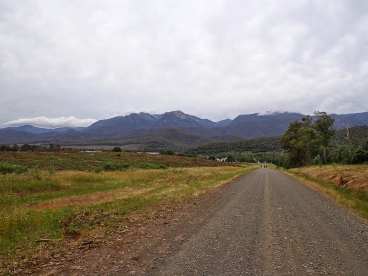
The first river crossing on my recent trip, taken yesterday.

That’s at about 550m. I went to about 1200m. Would be a different trip this weekend!
Nice!
That through the rubicon area? and there is an old aquaduct and sawmill the other side of the hill?
Anyone got good roads… lake elizabeth to anglesea-ish
Then anglesea to a train station. Rougher the better.
Look up the page at post 8! Don’t go down to Lorne just continue on to Seaview rd, then from Bambra-Boonah road you can wing it down to Angelsea.
http://www.fixed.org.au/forums/f17/gravel-touring-road-questions-link-ups-30172/#post551426
How did i miss that? Doing a similar trip in a few weeks but detouring via the forrest MTB park.
Sorry.
All, good, if you need any other tips ask away.
Is there a thread for gear talk for stuff like MikeD has on his bike on first page? Would love to get some ideas on what everyone is using!
Not sure - Dont think I’ve seen two set ups the same. What are you doing and what do you want out of it?
I’ve had fantastic service from Bike Bag Dude Custom Frame Bags and Bikepacking Gear Australia
I’ve got a dual susp 29er and would want to do one or two nights max. Would need a bivvy + a bag for carrying any extra gear I imagine? I will give that link a look, thanks
Edit: Found this thread to give a read, talk about perfect timing! http://www.fixed.org.au/forums/f10/outdoor-equipment-what-should-i-get-26922/index13.html
Did the “dirt three peaks” yesterday with a crew out of Healesville.
Mnt St Leonard.
Mnt Vinegar
Mnt Donna Buang -ran out of time to go up the ‘other’ dirt way from the warburton end.
Should have maybe done in reverse but good loop, the Mnt Vingar climb is tough.
^Sounds interesting. Where’s Mt Vinegar? And did you go Rawland or CX? (Donna at least I’ve found to be fine on roadie with 28mm tyres).
Mnt Vinegar is south from Narbethong, you drop back down onto Acheron way.
Def best on the rawland/rigid 29er, some very rough descents.
yeah, we were gonna go up some crazy singletrack/fire road way from the that JC knew but ran out of time, made it back to White Rabbit with 2min for a schooner.
Would have been fine for time, if not for 1 broken spoke/busted mech/flat tyre episode, 3 other flats.
Returned Tuesday night after a 4 day credit card tour with three friends from Lilydale to Wangaratta 489km. Included some extremely rough and steep terrain between Mirimbah and Whitfield…
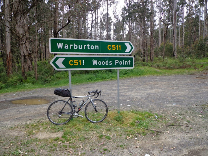
Day one 163km from Lilydale to Jamieson roughly half sealed - Warburton rail trail, Reefton Spur, Eildon Warburton rd (not one car!) and finally over a tough climb at around 140km in to finally descend into Jamieson.
Bike set up using my Revelate Designs Viscacha which works amazingly including numerous jumps over water bars day two!
Eildon Warburton rd

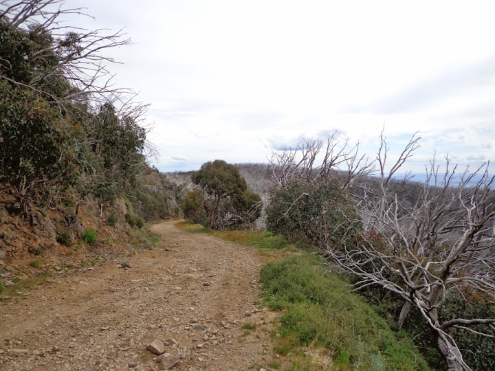
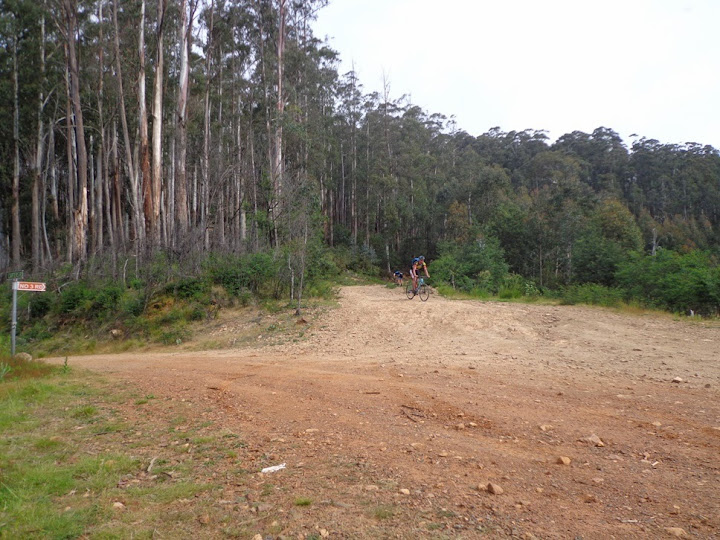
Day two Jamieson to Whitfield over Mt Stirling 133km and some extremely steep and rough 4WD tracks.
No 3 Road view at around 1550m above sea level

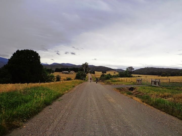
Day three 104km. Was to go over the back of Mt Buffalo via the Goldie Spur track, but the inclement weather had us taking the safer option to Myrtleford and then onto Bright.
Day 4 88km Cruise into Wangaratta via the rail trail and couple of hours enjoying the three course degustation option at Gapsted winery…

Fucking rad man. Jealous as.